
Built from Experts, Research and a Ride
I interviewed a civil engineer, a transportation engineer and the executive director of a youth cycling non-profit. I paired their insight with municipal plans, academic research and a ride simulating a student's commute to a Calgary high school.
As a cyclist living near downtown, I checked my own bias against reports and sources with differing views. Interview transcripts stay private; the maps are my synthesis.
Problem Snapshot
Car-centric infrastructure and opposition to bike lanes reinforce each other, limiting access to safe routes and lowering how safe cyclists feel.
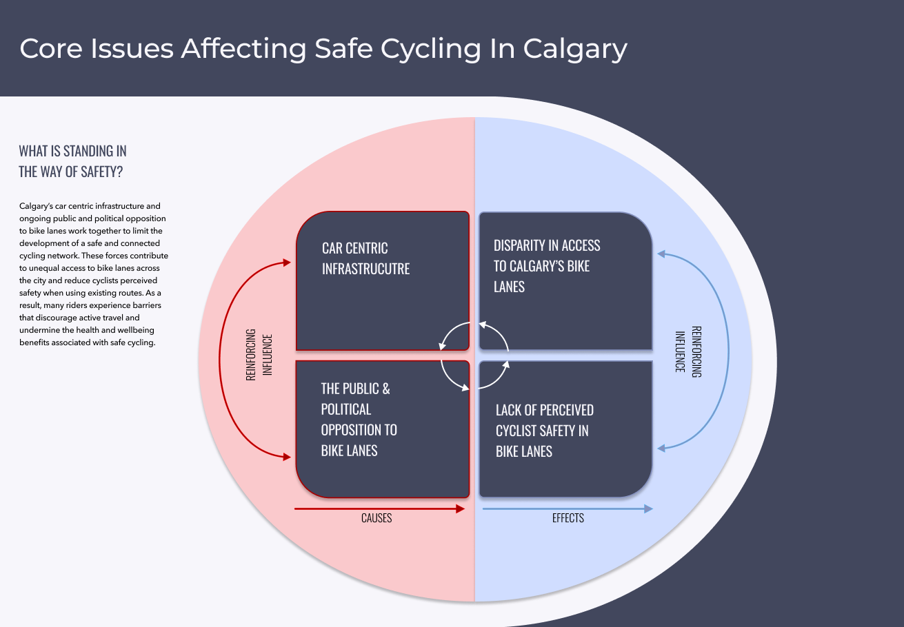
Causal Map
Driver behaviour, infrastructure, community support and cyclist experience all shape how safe riders feel. Safer, connected infrastructure leads to more riders and better health outcomes.
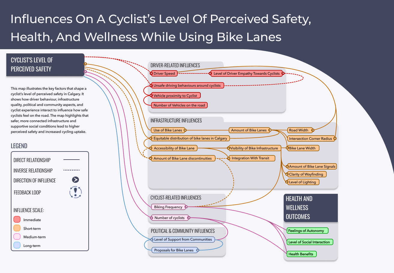
Actor Map
Tension between municipal and provincial government affects whether Calgary's bike network gets finished. Supporters of cycling rely heavily on the city to keep routes safe.
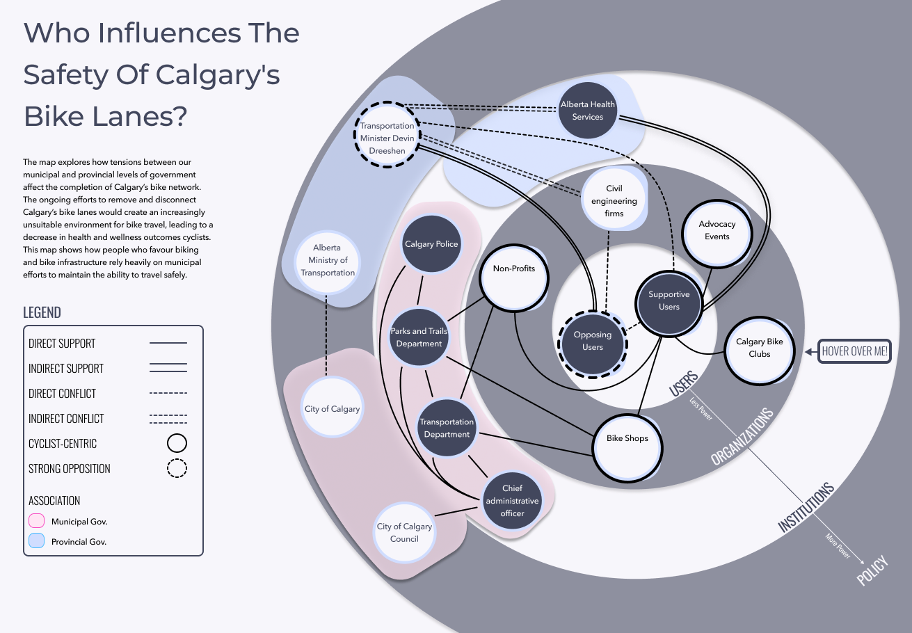
Rich Context and Leverage Points
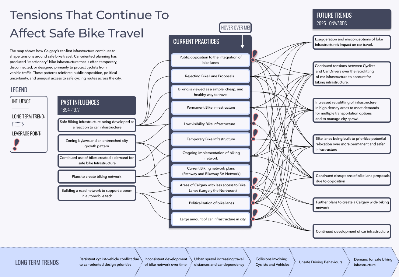
Car-first planning has produced "reactionary" bike lanes that are often temporary or disconnected, which fuels opposition. I marked where an intervention could shift the system, for example:
- Support education programs that correct misconceptions about bike lanes.
- Add clear signage, lighting, signals and snow clearing so routes are easy to find and their use is visible.
What I Learned
- Feeling safe matters as much as being safe. If a route doesn't feel safe, people won't ride it.
- Gaps break the network. Lanes that stop short undo the value of the routes around them.
- Some routes are invisible. Better wayfinding helps people find the lanes that already exist.
- Infrastructure is political. Communication and education are part of the design problem.
Next Steps
I later exhibited these maps as interactive pieces, where hovering revealed details and brought related factors into focus. Visitors wrote down their own stance on bike lanes after exploring them. If I continued this project, I would:
- Simplify the maps further, so passing viewers grasp the core ideas without needing to interact.
- Show more of my process, such as the first version of my causal map built in Miro.
- Fine-tune the content for a smoother experience, which time constraints limited.
Sources: City of Calgary (2024), Safer Mobility Plan 2024–2028; Doran, El-Geneidy and Manaugh (2021), The pursuit of cycling equity: A review of Canadian transport plans; Fruhen, Rossen and Griffin (2019), The factors shaping car drivers' attitudes towards cyclists and their impact on behaviour; Wilson and Mitra (2020), Implementing cycling infrastructure in a politicized space: Lessons from Toronto, Canada.
Next case study TELUS Spark Navigation Redesign